


Established 18 years ago in a location that stretches over the municipalities of Santarém and Aveiro, the Tapajós-Arapiuns Harvesting Reserve is one of the best-conserved green areas in Pará, the Brazilian state that has accumulated the largest deforested area in the Amazon between 1988 to 2016.
The reserve, comprised of 74 communities, combines income-generating activities for residents with conservation of the Amazon rainforest.
The area stands out in the Amazon region for its management model. The communities are organized into about 50 local associations under a parent association called Tapajoara, with membership in the reserve’s management council. All decisions are submitted to the council, and the population has an active voice there.
Other members of the council include the Chico Mendes Institute for Biodiversity Conservation (ICMBio) in charge of managing the territory, as well as representatives from state and municipal administrations, universities, non-governmental organizations, and cooperatives.
The population’s living standards have improved since the reserve was created. Educational services have expanded, as well as the number of projects funded by organizations and conducted through university cooperation. Despite the advances, the community still requires further improvements, especially in health and education, which continue to have poor standards.
“The main purposes of the harvesting reserve were environmental conservancy and decent living standards for residents. But there’s so much we still need. We lack qualified teachers and proper facilities at schools,” said the chair of the Vila Franca Community Association and Tapajoara representative, Raimundo Guimarães Gamboa, 58. He pointed out that only six of the communities have local healthcare centers.
Residents are also calling for improved telecommunications, with wider access to telephone and Internet services. “In some communities, radio is the only available medium for communication,” Gamboa said.
The poor basic services are leading communities to organize themselves to take care of the place they live. At the puxiruns, or community drives, residents volunteer carrying out community work. One day every week, they pull together to clean streets, plant trees, and do other activities. On those days, usually no work is charged or paid for.
“In addition to the community drives, anyone can call people to action. For example, if I have to clean a street or farm crops, I invite people and arrange a meal. We make a big panful of beans-and-flour and everybody joins in to help with work,” 69-year-old São Pedro community dweller José Rosário Fonseca explained.
Tugurrilho, as he is known, has seen the creation of the reserve and stood up for it. “We worked hard for it, we faced death threats from loggers, nobody seemed to care much. But we’ve made it, this has been the reserve that took the shortest to create,” he said. “Things have improved since then. We gained the legal rights to our land, and now we can work on it rather than destroy as others were doing.”
The reserve spans over an area of 677,513 hectares. It was created on November 6, 1998 by community demand, to protect riverside territories from the advances of loggers that operated in the region. A total 3,660 families (about 15,300 people) live in the 74 communities that make up the reserve. It is managed by the Chico Mendes Institute for Biodiversity Conservation (ICMBio).
The Amazon rainforest spreads over an area of 7.5 million km² (stretching over nine countries), and covers 40% of South America. It is the world’s largest and most important tropical forest and is home to the world’s largest river basin with 20% of the planet’s fresh water.
The Amazon Protection Areas Program (ARPA) is the world’s largest rainforest conservancy project. Coordinated by Brazil’s Ministry for the Environment, the project has supported the creation and development of federal and state conservancy units in the Amazon since 2002.
Currently, the program manages 114 conservancy (45 federal and 69 state) units and provides equipment, service contracting, and other initiatives required for managing the units.
The project is a collaboration with the state government of Amazonas, the Chico Mendes Institute for Biodiversity Conservation (ICMBio), the Global Environment Facility (GEF), the World Bank, the KfW (a Germany-based financial cooperation bank), WWF Brazil, the Brazilian Biodiversity Fund (FunBio) and civil society organisations.
Another Side
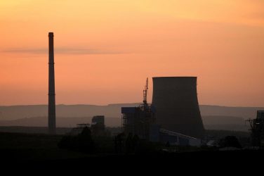
The Amazon lost 7,989 square kilometres of rainforest between August 2015 and July 2016, according to a survey published by the Amazon Environmental Research Institute (IPAM) based on late 2016 government data.
This is the largest annual deforestation figure since 2008, equivalent to 128 football fields of forest being slashed every hour according to IPAM.
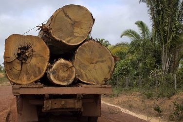
Little has changed in the land distribution of the devastation: the largest portion of the total area deforested over the 12-month period consisted of private properties (35.4%), followed by land reform settlements (28.6%), unassigned public land (24%) and conservancy units (12%).
According to the 2016 Amazon Deforestation Report (original Portuguese title: Panorama do Desmatamento da Amazônia 2016), the states with the largest increase in deforestation rates were Amazonas, Acre and Pará, with 54%, 47% and 41% respectively.
In absolute terms, the largest deforestation was seen in Pará (3,025 km²), followed by Mato Grosso (1,508 km²) and Rondônia (1,394 km²). The three states combined accounted for 75% of the total deforested area in 2016.
The study has exposed the need to engage society in deforestation controls “with a new command and control framework for projects, a positive agenda of incentives to production efficiencies in existing deforested areas, and better support for protecting one’s forest assets, as well as a larger role of business and banks in anti-deforestation controls.”
Since 2004, deforestation in the Amazon rainforest has been reduced by more than 70%, after the second-highest peak ever since it has been monitored (27,772 km²).
Between 2009 and 2015, it stabilised at an average 6,080 km² per year, with the year 2012 seeing the lowest deforestation rate in the last 20 years (4,571 km²). After 2012, deforestation began to increase successively with only minor dips.
The data from IPAM’s report was obtained from the Amazon Deforestation Monitoring Project (PRODES).
ABr


